
Articles
- Page Path
- HOME > GEO DATA > Volume 3(1); 2021 > Article
-
Article
Ecology
한반도 남서부 지역(전남, 광주, 제주)의 야생 포유류 분포 현황 데이터 - 임치홍*, 김민식, 이정현, 범현민, 김남신, 김철구, 차진열
- Dataset of wild mammals distribution in the southwestern area (Jeollanam-do, Gwangju Metropolitan City and Jeju island) of Korean Peninsula
- Chi Hong Lim*, Min Sik Kim, Jung Hyun Lee, Hyun Min Bum, Nam Shin Kim, Chulgoo Kim, Jin Yeol Cha
-
GEO DATA 2021;3(1):1-11.
DOI: https://doi.org/10.22761/DJ2021.3.1.001
Published online: March 31, 2021
국립생태원 생태조사연구실, 서천 33657, 대한민국
Division of Ecological Survey Research, National Institute of Ecology, Seocheon 33657, Republic of Korea
- *Corresponding author: sync03@nie.re.kr
Copyright © 2021 GeoAI Data Society
This is an Open Access article distributed under the terms of the Creative Commons Attribution Non-Commercial License (http://creativecommons.org/licenses/by-nc/3.0/) which permits unrestricted non-commercial use, distribution, and reproduction in any medium, provided the original work is properly cited.
- 521 Views
- 25 Download
요약문
- 제4차 전국자연환경조사의 결과는 국토 생태환경에 대한 최신의 현황을 반영하고 있다. 본 연구에서는 전라남도, 광주광역시, 제주도를 포함하는 한반도 남서부 지역에서 제4차 전국자연환경조사를 통해 수집된 포유류 개체 분포 현황에 대한 데이터를 제시하였다. 본 데이터는 현장에서 기록된 포유류 개체의 정보와 기록된 지점의 비생물 환경 특성 정보로 구성되어 있으며, 통계 산출을 위해 필요한 공간 단위(행정구역, 도엽 등) 정보를 포함하고 있다. 본 데이터를 통해 포유류 출현 지점의 서식환경적 특징을 파악할 수 있으며, 포유류의 풍부도(단위지역 내에 서식하는 개체의 수)와 서식환경과의 관계를 규명할 수 있다는 점에서 자연환경정책 지원 가능성 및 학술적 가치가 높다고 판단된다. 그러나 전국자연 환경조사는 전국토 규모에서 수행되는 생태환경 조사사업이므로 지역적 규모에서의 활용도를 높이기 위해서는 조사지역의 선정 방법 등 조사체계에 대한 고려가 선행되어야 한다.
Abstract
- The results of the 4th National Ecological Survey reflect the latest status of the ecological environment in South Korea. In this study, we presented spatial data on the distribution of mammals collected through the 4th National Ecological Survey in the southwestern area of the Korean Peninsula, covering Jeollanam-do, Gwangju Metropolitan City and Jeju island. The data consists of information on mammal individuals recorded at the site and information on characteristics of abiotic environment at the recorded points, including spatial units (administrative districts, digital map index, etc.) which are necessary for statistical analysis. The data have high policy and research values because it can elaborate on the descriptive characteristics of the distribution points and identify the relationship between individual abundance and habitat environment. However, when data is utilized in a regional scale, it should precede to consider the survey system, such as how to select the survey area.
- 국립생태원은 자연환경보전정책 수립의 기반이 되는 국가생태환경정보를 확보하기 위하여 전국자연환경조사를 실시하고 있다. 전국자연환경조사는 1986년에 최초 실시된 이래 1991년 제정된 「자연환경보전법」에 근거하여 1997년 이후 지속적으로 수행되고 있으며, 주요 내용은 단위 시기(현행법 기준 5년)동안 전 국토의 자연생태환경(포유류, 조류 등 7개 생물 분류군과 식생, 지형의 2개 분야 등 총 9개 분야)의 정보를 수집하고, 기존의 정보를 갱신하는 것이다. 2018년까지 총 4차에 걸친 전국자연환경조사가 완료되었으며, 2019년부터는 제5차 전국자연환경조사가 수행되고 있다. 따라서 제4차 전국자연환경조사(2014년~2018년)는 가장 최근에 완료된 조사로, 그 결과는 국토 생태환경에 대한 최신의 현황을 반영하고 있다.
- 본 데이터는 제4차 전국자연환경조사에서 수집된 한반도 남서부 지역(전라남도, 광주광역시, 제주도)의 포유류종 출현 확인 지점의 위치 및 서식환경에 대한 정보로 구성되어있다. 데이터의 속성정보에 조사를 통해 기록된 생물 정보 외에도 타 기관에 의해 구축된 주제도로부터 확인된 출현 지점의 비생물 환경에 대한 정보를 함께 포함하여 각 포유류 종이 이용하는 서식환경의 특성을 분석하는 데 이용할 수 있도록 구성하였다. 또한, 행정적 통계 산출에 활용할 수 있도록 국가 행정 경계에 대한 정보를 추가하였다. 본 데이터는 학술연구의 기초자료, 자연환경통계 산출의 기초자료, 국가 및 지자체 단위의 환경계획 및 개발계획 수립 등에 활용할 가치가 높다.
1. 서론
- 2.1. 연구지역 개황 및 조사지역 선정
- 연구지역은 위도 33.11˚ ~ 35.49˚ N, 경도 125.08˚ ~ 127.91˚ E에 위치한 한반도 서남해안 및 내륙 일대로, 행정구역 상 전라남도, 광주광역시, 제주특별자치도에 속하며, 1개 광역시, 7개 시, 17개 군으로 구성되어 있다(Fig. 1). 연구지역의 해발고도는 0 ~ 1,919 m 분포를 나타낸다. 전라남도의 연평균기온은 13.6℃, 연평균강수량은 1,383.3 mm이고, 광주광역시의 연평균기온은 13.8℃, 연평균강수량은 1,391.0 mm이며, 제주도의 연평균기온은 15.5℃, 연평균강수량은 1,456.9 mm이다(기상청, 2020).
- 2.2. 조사지역 선정
- 연구지역 내 조사지역은 연구지역을 소단위(1:25,000 축척 지형도 1개 도엽을 경위도 각 2’ 30’’ 간격으로 9등분한 격자)로 구분한 후 각 소단위 별로 1개 지점 이상을 선정하였다. 선정 시 기존 문헌 및 조사내역을 통해 포유류의 기 서식현황, 멸종위기종의 서식 유무 등을 참고하였고, 지리적 상황, 식생현황, 접근성 등을 고려하여 조사가 용이하고 그 지역의 포유류상이 가장 잘 파악될 수 있는 장소나 경로를 선택하였다.
- 2.3. 자료 취득
- 2015년부터 2018년까지 조사지역을 대상으로 포유류 분포 현황(출현종, 출현시기, 출현지점 등)을 파악하였다. 조사기간은 매년 3월부터 11월 말까지로, 지역 당 조사 횟수는 연 1회 이상, 멸종위기 야생생물이 확인될 경우 2회이상 수행하는 하는 것을 기준으로 하였다. 조사 시 중대형 포유류, 소형 포유류, 박쥐류에 대한 현지조사 방법과 무인센서카메라를 활용한 간접조사방법을 활용하였으며, 세부적인 방법 및 절차는 제4차 전국자연환경조사 지침(환경부·국립환경과학원, 2012; 국립생태원, 2016)을 준용하였다. 조사를 통하여 획득된 서식증거와 GPS를 활용하여 기록한 WGS1984 타원체의 경위도 좌표를 자연환경조사결과 입력 시스템에 입력하여 스프레드시트 형태의 현지조사 정보 데이터를 구축하였다.
- 2.4. 자료 구축 및 분석
- 조사 결과 정보 데이터에 기록된 포유류 분포 지점의 좌표 및 내용을 기반으로 점 형태의 벡터 형식 공간정보(이하 DB)를 구축하였다. 구축된 DB와 조사계획, 현장조사 보고서 등을 비교하여 오류를 검수하였고, 오류 정보는 조사자의 검정을 통하여 수정하였다. 각 분포 지점의 서식환경을 고려할 수 있도록 구축된 DB의 위치정보를 기반으로 토지이용현황, 산림 특성, 도로 접근성, 수계 접근성, 해발고도 등의 비생물환경 정보를 추출하였고, 통계 및 현황 파악에 활용할 수 있도록 수치지형도 도엽 정보 및 행정구역 정보를 추출하여 속성정보에 포함하였다(Table 1). 최종 DB의 속성정보 항목을 Table 2에 제시하였다.
2. 본론
- 3.1. 포유류 분포 지점의 기술적 특징
- 담비, 삵, 수달, 하늘다람쥐 등 환경부 지정 멸종위기야생생물 4종을 포함한 총 15과 28속 34종의 총 6,467개 분포 지점을 DB로 구축하였다(Fig. 2). 분포가 가장 많이 확인된 종은 1,486개 지점에서 분포가 확인된 고라니였고, 멸종위기야생생물 Ⅱ급 종인 삵이 1,079개 지점으로 두번째로 많은 분포가 확인된 종이었다. 이어 너구리(691개 지점), 멸종위기야생생물 Ⅰ급 종 수달(685개 지점) 등이 분포 확인 지점 수가 많은 종으로 나타났다(Table 3). 지자체 별 포유류의 분포현황에서 가장 많은 지자체는 장흥군으로 861개 지점의 포유류 분포가 확인되었고, 해남군(554개 지점), 보성군(508개 지점)의 순으로 나타났다(Fig.2 and 3, Table 4).
- 3.2. 포유류 분포 지점의 서식 환경적 특징
- 토지이용 측면에서 가장 많은 포유류 개체가 관찰된 유형은 산림으로 2,749개 지점에서 관찰되었으며, 이어서 초지(1,141개 지점), 농경지(791개 지점) 등의 순이었고, 753개 지점의 개발지에서도 포유류의 분포가 관찰되었다(Fig. 5). 연구지역에서 관찰된 개체수 상위 7개 종의 토지이용별 분포현황을 분석한 결과, 대부분의 종의 경우 산림에서 가장 많은 흔적이 기록되었고, 농경지와 초지 등에서도 그 빈도가 높았다. 그러나 수달의 경우에는 수체와 습지 등 수변구역에서 가장 많은 흔적이 기록되었고, 개발지에서 기록된 빈도 또한 높아 다른 종들과 구분되는 서식환경 특징을 나타내었다(Table 5, Fig. 7). 또한, 해발고도 500 m 이하의 지역에서 전체 분포 지점 중 약 95%의 지점이 기록되었으며, 700 m 이상에서는 분포 지점이 거의 없었다(Fig. 4 and 6).
3. 결과
- 4.1. 생태조사자료의 공간정보 구축의 정확도 제고
- 현장에서 조사된 생태조사자료의 공간데이터로 구축은 수기로 기록된 야장(field note)의 조사항목 별 정보와 GPS 장비를 통해 취득한 좌표를 스프레드시트 형태의 데이터베이스에 입력하고, 이를 공간정보로 전환하는 과정으로 이루어진다. 이러한 자료는 점(point) 형태로 구축되기 때문에 중복(overlap), 교차(intersect) 등 위치정보의 편집과정에서 발생하는 위상논리적 오류(topological logic error) 등의 발생가능성은 적지만, 속성정보의 편집과정에서 야장에 기록된 정보의 오기, 동일 정보에 대한 다른 형식의 기록, 공통 기준에 대한 미준수 등에 의한 정보의 오류 또는 손실이 발생할 수 있다. 특히, 일부 오류는 공간정보의 정확도를 심각한 훼손할 수 있어 구축 과정에서 세심한 주의를 요한다.
- 가장 빈번히 발생하는 오류는 좌표 오기로, 공간정보의 정확도에 가장 치명적인 영향을 미치는 동시에 오류의 수정이 어려운 유형이다. 현재는 보고서 등에 기록된 조사계획지역과 실제 공간정보 상의 위치를 비교하여 오류가 확인된 경우 조사자의 확인을 거쳐 위치를 수정하고 있으나, 지형도 등의 참조정보를 통하여 조사지점과 유사한 위치로 보정하는 것이므로 실제 조사지점과 일부 오차가 발생한다. 이러한 오류를 최소화하기 위해서는 조사 정보의 기록 방식을 수기 야장 방식에서 휴대폰, 태블릿 PC 등의 휴대용 매체를 이용한 디지털 야장 방식으로 개선하여 데이터베이스 자료로의 가공단계를 줄이는 것이 필요하다.
- 자료 구축 시 빈번히 발생하는 또 하나의 오류 유형은 조사지침에 규정된 기준을 준수하지 않아 발생하는 동종이명 등의 오류로, 이 경우 종 다양성, 서식환경과의 상관성 등 각종 통계치의 왜곡이 발생할 수 있다. 이러한 오류를 최소화하는 방법으로는 기준으로 설정된 입력값을 코드성데이터로 규격화하고, 데이터 입력 시 해당 데이터 내에서 일치하는 값을 찾아 선택하여 입력하는 방식을 적용할 필요가 있다.
- 국립생태원에서는 이와 같은 오류를 최소화하여 데이터의 정확도를 제고하기 위하여 조사자가 조사정보를 온라인으로 직접 입력할 수 있는 조사자료 입력시스템을 운영하고 있다. 2018년부터는 해당 입력시스템에서 상기한 오류사항들에 대한 검수 기능을 활용하고 있어 향후에는 이전 대비 높은 정확도의 데이터 구축이 가능할 것으로 예상된다.
- 4.2. 효과적인 데이터 활용을 위한 고려사항
- 본 연구를 통해 제시한 데이터는 한반도 남서부에 서식하는 포유류의 최신 분포현황을 나타내는 것으로 현장에서 기록된 포유류 개체의 정보와 기록된 지점의 서식환경 특성 정보로 구성되어 있다. 본 데이터는 다양한 측면에서 활용가치가 높다고 판단된다. 정책적 측면에서는 생물다양성 현황 파악, 자연환경에 관한 통계 산출, 환경 및 개발계획 수립, 보호지역 지정 등의 정책 수립의 근거자료로 활용될 수 있다. 또한 생물학, 생태학, 조경학, 임학 분야 등에서 연구기초자료로서 활용될 수 있고, 출현 정보 외에 서식환경에 대한 정보를 포함하고 있으므로 토지이용변화나 기후변화에 따른 서식지 변화가 유발하는 종 분포의 변화 예측 등에 활발히 활용될 수 있을 것으로 기대한다.
- 전국자연환경조사는 우리나라 전 국토 범위를 대상으로 수행되는 생물 인벤토리 조사 중 조사인력 및 비용이 가장 많이 투입되는 조사로, 소단위당 적어도 1개 지점 이상의 조사를 수행하고 있어 국가 규모에서 볼 때 특정 지역에 조사가 치중되지 않은 고른 샘플링 체계를 가지고 있으며, 따라서 조사자료의 신뢰성이 매우 높다고 볼 수 있다. 그러나 지자체 행정구역, 소단위 구획의 기준이 되는 수치지형도 도엽 등 지역적 규모에서 자료를 활용할 때에는 조사지역의 선정 방법 등에 대한 주의가 필요하다. 특히 포유류 종의 출현과 출현 환경의 상관관계를 도출하거나 해석하고자 할 때에는 이러한 측면을 반드시 고려하여야 한다. 예를 들어, 본 연구에서 가장 많은 포유류 개체가 확인된 토지이용유형은 산림과 초지였다. 이러한 결과만 보면 서식지의 높은 자연성이 포유류 종의 풍부도에 영향을 미치는 것으로 해석할 수 있으나, 야생포유류종의 현황 파악이라는 조사의 목적 상 야생포유류의 출현가능성이 높은 토지이용 유형 중심의 조사지역 샘플링 편향(bias)이 존재하므로, 왜곡된 해석일 가능성이 존재한다. 또한, 대부분의 포유류 개체가 저해발 지역에서 확인되었기 때문에 해발고도와 포유류 종의 분포 간의 상관관계가 있다고 해석할 수 있으나, 이러한 결과에는 고해발지역의 낮은 접근성 등에 의한 조사 지점 수의 제한이 영향이나, 전남 동부지역 및 제주도 한라산 등 일부 산지보다는 낮은 고도의 평야 및 평지, 해안의 면적이 넓은 연구지역의 지형적 특징이 반영된 것일 수도 있다고 판단된다.
4. 결론 및 토의
-
Acknowledgements
- 본 연구는 ‘NIE-법정연구-2021-03 자연환경종합 GIS-DB 구축’ 사업의 일환으로 수행되었음
-
저자 역할
임치홍: 연구설계, 데이터분석, 원고 작성; 범현민, 이정현: 공간정보 구축, 데이터 검수; 김민식: 현장조사; 김남신: 데이터 구축 총괄; 김철구: 현장조사 총괄; 차진열: 사업 총괄. 원고에 대한 검토 및 수정은 모든 저자가 함께 수행하였음
Notes


- 국립생태원 (2016) 2016년 전국자연환경조사 지침, 국립생태원
- 기상청 홈페이지 (2020) https://www.weather.go.kr/weather/climate/average_regional.jsp (accessed on 23 December 2020)
- 환경부·국립환경과학원 (2012) 제4차 전국자연환경조사 지침, 환경부·국립환경과학원
참고문헌
Appendix
Figure & Data
References
Citations
 PubReader
 ePub Link
 Cite
Cite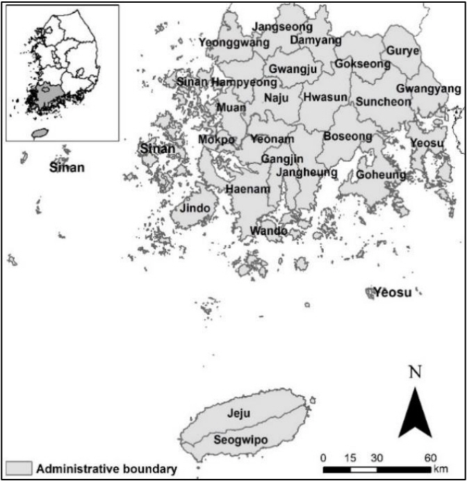


#816, 8-13, Gwangpyeong-ro 56-gil, Gangnam-gu, 06367 Seoul, South Korea
Tel: +82-2-6677-5682 E-mail: geodata@gaidas.org
Corporate registration number: 780-82-00418
