
Previous issues
- Page Path
- HOME > Articles and Issues > Previous issues
- Volume 4(1); March 2022
-


Review
- Data used for GIS-based Flood Susceptibility Mapping
- Saro Lee, Fatemeh Rezaie
- GEO DATA. 2022;4(1):1-15. Published online March 31, 2022
- DOI: https://doi.org/10.22761/DJ2022.4.1.001

- 1,009 View
- 93 Download
-
 Abstract
 PDF
PDF - The dramatic increase in flood incidents as a significant threat to human life and property, environment, and infrastructure indicates the necessity of mapping spatial distribution of flood susceptible areas to reduce destructive effects of flooding. During the last decade, the integration of the geographic information system (GIS) with the remote sensing data provide efficient means to generate a more reliable and precise flood susceptibility map. The present study contains a review of 200 articles on the application of GIS-based methods in indicating flood vulnerable areas. The papers were reviewed in terms of influential variables, study area, and the number of articles published in the last 10 years. The review shows that the number of studies has increased since 2012. The total study areas covered 39 countries that were mostly located in Asia where the major developments and infrastructures have been constructed in the floodplains. The most common study areas was Iran (44 articles, 22%), followed by India (26 articles, 13%), China (26 articles, 11%), and Vietnam (15 articles, 7.5%). More than 90 variables were considered to map flood susceptible areas that the top 5 widely used flood conditioning factor are slope (98% of total articles), followed by elevation (92% of total articles), land use/land cover (79.5% of total articles), distance to the river (76.5% of total articles), and rainfall (73% of total articles). The review implies that many natural and anthropogenic factors affect flooding and the combination of both groups of factors is necessary to accurately detect and map flood-prone parts of the study area.
Articles
- Development of the Method for Authentication of the Genus Anguilla Sold on the Korean Fish Market and Current Status of Distribution
- Yo-Soon Jang
- GEO DATA. 2022;4(1):16-26. Published online March 31, 2022
- DOI: https://doi.org/10.22761/DJ2022.4.1.002
- 596 View
- 30 Download
-
Abstract
PDF
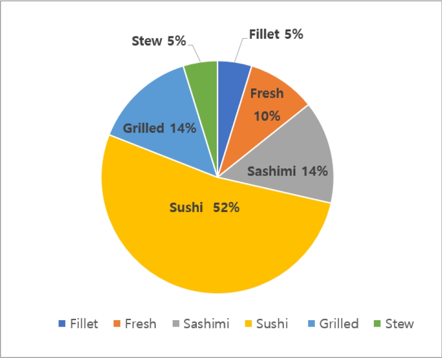
- This study was carried out to identify the mislabeling of Japanese eel (Anguilla japonica) sold on the fish markets in Korea and to develop a method for determining the authenticity of fresh and trimmed eels. Between January and December 2018, 31 test samples were collected from restaurants and fish markets in Seoul, South Korea, and the collected samples were analyzed. The results showed that over two-thirds of the samples tested were mislabeled. Molecular identification of 31 test samples revealed that 10 Anguilla japonica, 9 Anguilla Anguilla, 2 Anguilla rostrate, 1 Anguilla marmorata, 7 Ophichthus remiger, 1 Brachysomophis crocodilinus, and 1 Conger myriaster. We have developed the NdeⅠPCR-RFLP assay for determining the authentication of fresh and trimmed eels sold on the fish markets in Korea, and this assay enables rapidly and accurately identify the genus Anguilla.
- The Dataset of UAV Based High-resolution Tidal Topography at the Nakdong Estuary: Focusing on Jin-u Island and Shin-ja Island
- Yeongjae Jang, Jingyo Lee, Joo-Hyung Ryu, Kye-Lim Kim, Hahn Chul Jung, Keunyong Kim
- GEO DATA. 2022;4(1):27-36. Published online March 31, 2022
- DOI: https://doi.org/10.22761/DJ2022.4.1.003
- 923 View
- 31 Download
- 1 Citations
-
Abstract
PDF
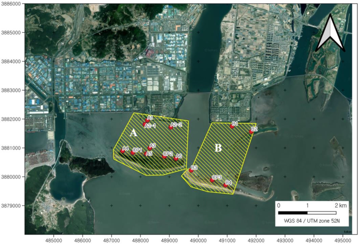
- In the tidal flats of the Nakdong Estuary, eight weirs were installed as part of the Four Major River Restoration Project in 2011, and the environment changed from a flowing stream to a still water stream. As the Nakdong River’s weir was permanently opened in February 2022, the topography and ecological environment are expected to large change. In this study, Unmanned Aerial Vehicle (UAV) photogrammetry was conducted on the tidal flats of the Nakdong Estuary in November 2021, the environment before the Nakdong River floodgates were opened. The study area was surveyed using the Network-RTK (Real-Time Kinematic) method to obtain Ground Control Point (GCP), and using an UAV, orthographic image and digital elevation model were generated for an area of 3.47 ㎢ near Jin-u island and 2.75 ㎢ near Shin-ja island. A result of spatial resolution of 1.8 cm was obtained, the result was verified using checkpoints, and results with accuracy exceeding 1 cm were obtained in both Sin-u Island and Jin-woo Island. In the future, changes in the topography and sedimentation environment of this area are expected, so it will be useful data for various research and conservation management.
-
Citations
Citations to this article as recorded by
- Influence of Precipitation Conditions and Discharge Rates of River Estuary Barrages on Geomorphological Changes in an Estuarine Area
Sung-Bo Kim, Doo-Pyo Kim
Applied Sciences.2023; 13(17): 9661. CrossRef
- Influence of Precipitation Conditions and Discharge Rates of River Estuary Barrages on Geomorphological Changes in an Estuarine Area
- TanDEM-X-based Ganghwa Tidal Flat High-resolution Topographic Map Construction and Service
- Ga Ram Yun, Joo-Hyung Ryu, Kye Lim Kim, Jin Hyung Lee, Seung-Kuk Lee
- GEO DATA. 2022;4(1):37-42. Published online March 31, 2022
- DOI: https://doi.org/10.22761/DJ2022.4.1.004
- 468 View
- 31 Download
-
Abstract
PDF
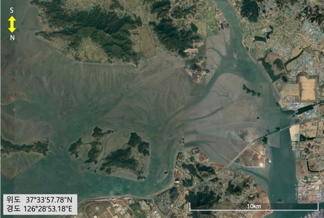
- This study extracted the data of Digital Elevation Model (DEM), tidal channel, and tidal channel density, slope based on TanDEM-X satellite of Ganghwa tidal flat. Monitoring and analysis of the decrease in the area of tidal flats in Korea are of great importance, and by judging the efficiency and accuracy in time and space, satellite data were obtained according to the analysis topic of the tidal flats. Since the west coast occupies a large proportion of domestic tidal flats, Ganghwa-do tidal flats were designated as the scope of the study. The produced materials are provided in the form of GEOTIFF(.tif) or Shape(.shp) files. To utilize the tidal flat data constructed in this way, it can be downloaded from the Environmental Big Data website (www.bigdata-environment.kr), an environmental business big data platform.
- AI Dataset for Road Detection using KOMPSAT Images
- Hoonhee Lee, Han Oh
- GEO DATA. 2022;4(1):43-48. Published online March 31, 2022
- DOI: https://doi.org/10.22761/DJ2022.4.1.005
- 400 View
- 22 Download
-
Abstract
PDF
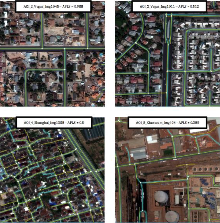
- Information on shape and type of road present in an optical image of satellite is useful for digital mapping and monitoring of road changes. Processing and structuring optical image data collected from payloads mounted on KOMPSAT 3 and 3A can accelerate the development of road detection algorithms and the extraction of road information using them. In particular, if it is built with a learning dataset for AI (Artificial Intelligence) prepared to apply deep learning technology, the latest artificial intelligence technology in the field of computer science can be spun off to the field of satellite image-based road detection to attempt a wide range of analysis. Korea Aerospace Research Institute constructed an image dataset for AI learning using satellite optical images with Korean companies, and this paper explains the type and size of datasets along with examples of the use of the dataset. The established data can be used through the website, aihub.or.kr.
 First
First Prev
Prev


Editorial Office of GEO DATA

#816, 8-13, Gwangpyeong-ro 56-gil, Gangnam-gu, 06367 Seoul, South Korea
Tel: +82-2-6677-5682 E-mail: geodata@gaidas.org
Corporate registration number: 780-82-00418